In Flanders, Engineering Structures Are Monitored From Space
- September 28, 2023
- Category: News

Large structures such as bridges have long been monitored by means of annual levelling surveys.
Although the results are highly accurate, this is a labor-intensive, high-cost approach that quickly reaches its limits.
InSAR for large-scale bridge monitoring
This is where space-based monitoring comes into its own, thanks to InSAR (Interferometric Synthetic Aperture Radar), which uses data from radar satellites to monitor hundreds of bridges simultaneously, at incomparably competitive cost and with unrivalled regularity.
Satellite imagery is already being used on a very large scale for the construction of the Grand Paris Express. Thanks to radar interferometry (InSAR), the specialists at TRE ALTAMIRA, the CLS subsidiary with expertise in infrastructure monitoring, are able to track ground deformations down to the millimetre, and measure the surface impact of civil engineering works.
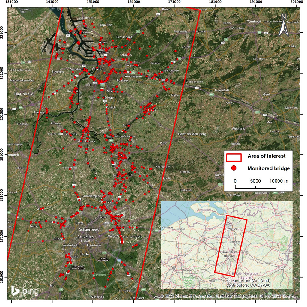
Radar satellites collect images that can be used to identify ground and building deformations with millimetric precision, without the need for installation or site visits. This is how the Flanders Department of Mobility and Public Works chose InSAR to monitor 1,300 bridges, thus demonstrating the added value of this cutting-edge technique for structural assessment of bridge health.
With Sentinel-1, reliable data even on cloudy days
Sentinel-1 is a constellation of 2 radar satellites, which follow a pole-to-pole trajectory. The radar collects data about the Earth in all weathers, even when it’s cloudy. This data can be used, for example, to check the stability of infrastructure.
Sentinel-1 satellites achieve a resolution of 5×20 m, comparable to the surface area of a warehouse.
Measurements down to the millimeter
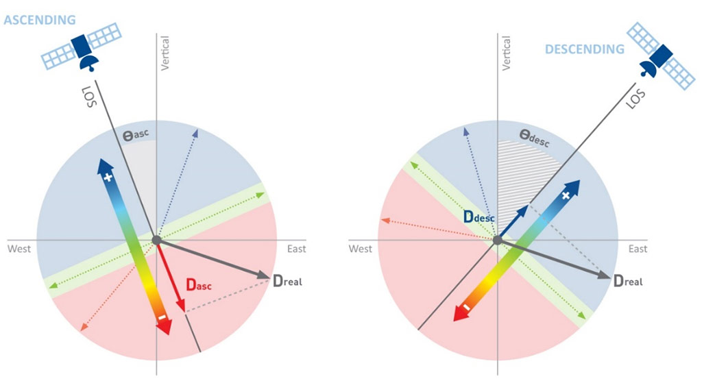
Ségolène Duprat, Satellite Imagery Expert at CLS subsidiary, explains what this technique involves: “Radar satellites record with great precision the distance covered by the radar signal between transmission and reception of the wave. By comparing the evolution of this distance over time, InSAR technology provides highly accurate information on ground deformation, enabling movements to be detected with millimetric precision. The SqueeSAR® algorithm, developed and patented by TRE ALTAMIRA, identifies ground targets for which it will be possible to assess displacement.”
At every stage of a project
InSAR can be deployed in all phases of a civil engineering project:
- Pre-construction assessment, thanks to an archive of satellite images built up since the early 1990s,
- During the construction phase: supply of monthly updates of surface movement measurements to the parties involved,
- In the post-construction phase, the InSAR study will be used to monitor ground stability.
The SqueeSAR® algorithm: high-precision information on surface deformations
SqueeSAR® is an algorithm developed and patented by TRE ALTAMIRA, belonging to the Persistent Scatterer Interferometry (PSI) software family. SqueeSAR® provides high-precision estimates of surface deformation based on the processing of radar images acquired over a given period and over the same area of interest.
SqueeSAR® detects ground targets for which it will be possible to evaluate displacement over the study period. These targets are of two types: Permanent Scatterers (PS), which are point targets that show very high reflectivity within a single image pixel (such as bridges, buildings, roads, etc.), and Distributed Scatterers (DS), which are extended targets that can be formed in certain environments, in the absence of a dominant reflector (PS), by grouping together homogeneous pixels to obtain a sufficiently strong reflection that is stable over time.
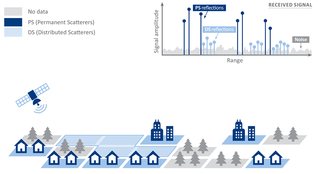
SqueeSAR® extracts precise information on the spatial location and movement of all targets identified in the area of interest.
Project challenges
Creation of a deformation history (settlement, uplift, stability) of 1,300 bridges and their surroundings over the period 2015 – 2022 through:
- Analysis of high-resolution images supplied by the Flemish government (TerraSAR-X satellite);
- Analysis of all Sentinel-1 images (ascending and descending geometry) acquired over the area since the mission was launched in 2014.
And highlighting anomalies to prevent any structural or environmental hazards.
Other challenges:
- Locating stable measurement points – PS & DS,
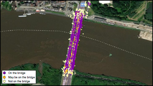
Figure 4: Location of measurement points detected by SqueeSAR® - Evaluation of the average annual displacement rate – for each PS and DS [mm/year] along the satellite line-of-sight,
- Display displacement time series – for each PS and DS along the LOS [mm],
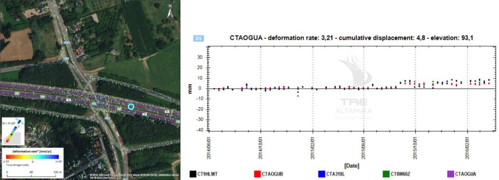
Figure 5: Left: TSX SqueeSAR® strain rate (mm/year). Right: Time series of the measurement point shown in blue - Accompanying the customer in the analysis of the results, who received, for each structure considered in the analysis, a complete document containing all the information and services provided by TRE Altamira.
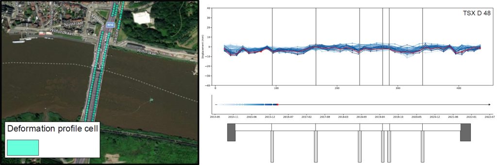
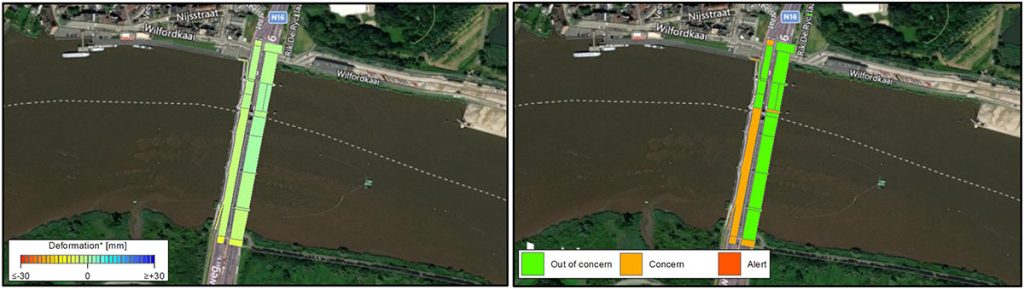
Figure 6: Automatically generated deformation profile and bridge diagram
A 3-level warning system
100% operational service
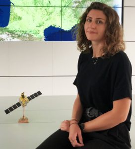
Ségolène Duprat comments: “We have a direct relationship with our customers, who come to us when a problem arises. This may be because no instrumentation has ever been carried out before, until an incident occurs. In this case, the client may ask us to carry out a retrospective study to determine the evolution of a landslide or settlement on an infrastructure, for example. We then process the satellite data that seems most relevant to the phenomenon to be observed.”
InSAR reduces the need for on-site visits, keeps costs down, and is a safety factor for operations. InSAR has proven its effectiveness and gained a reputation that has extended its field of activity to private and public players such as Société du Grand Paris, EDF, Total, RATP and SNCF in France.
We have also been involved in numerous tramway, metro and rail projects in Australia, Canada, Ecuador, Japan, Peru and the United States, and we are recognized as a key player in the field of mining surveillance on every continent, where the space-based solution has rapidly established itself for monitoring sites with potentially dangerous access, and as a decision-making tool for optimal control and safety of operations.