The state of Transalpine Dams monitored via Satellite
- February 2, 2022
- Category: News
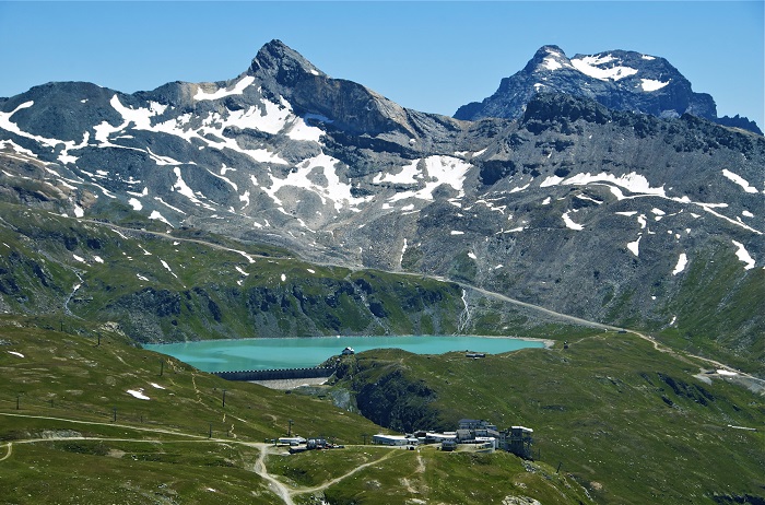
Dams, these concrete giants, have reshaped large parts of our territories, profoundly transforming the landscape.
A body of water pleasing to the eye, and which, in summer and winter, provides electricity that cannot be ignored.
In Italy, the contribution of dams to electricity production is far from negligible, accounting for an estimated 17% of the energy mix.
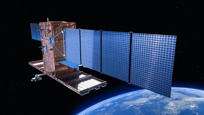
In the Italian Alps, in order to secure these artificial dams, improve prevention, communication and safety of the territories that could be impacted in case of cracking or worse, breakage of the structure, an original solution has been set up, surveillance from space, thanks to satellites that gravitate at an altitude of more than 600 km and which, despite the distance, have the capacity to measure with great precision what is happening on the ground.
These radar satellites, of the COSMO-SkyMed constellation, combined with the InSAR expertise of our subsidiary TRE ALTAMIRA, based in Milan, have enabled the monitoring of five dams within the framework of the RESBA project (for Resilience of Dams).
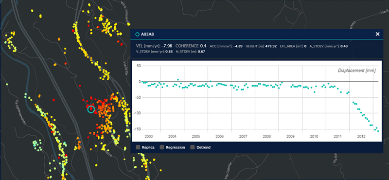
Closely monitored, since this innovative technique makes it possible to measure to the nearest millimeter any deformations that could occur and threaten the solidity of the installation. And thus providing increased security of these installations.
This RESBA project is part of the interregional ALCOTRA program, carried out in collaboration with the Autonomous Region of Valle d’Aosta, the Piedmont Region, the National Research Institute for Agriculture, Food and the Environment, the Polytechnic School of Turin and Turin Metropole.
The objective of the project is to secure these artificial dams in the Alpine regions and thereby improve prevention, communication and safety of the territories concerned in connection with the bodies in charge of Civil Protection.
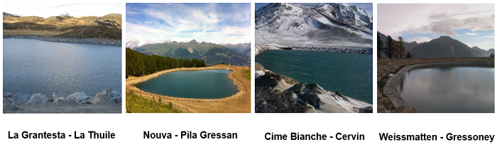
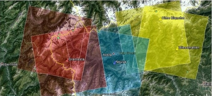
Five dams located in Valle d’Aosta will benefit from this surveillance from space:
- Gran Testa, area of La Thuile,
- Nouva, area of Gressan,
- Cime Bianche, area of Ayas,
- Weissmatten, area of Gressoney-Saint-Jean,
- Fourcaré, area of Champoluc.

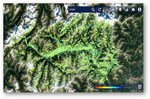
Satellite interferometry, here thanks to the Sentinel satellites, allows a continuous monitoring of the 5 dams located in Valle d’Aosta and an automatic analysis of the speed variations of the historical displacement data.
To go further, radar satellite imagery is widely used to monitor infrastructure in urban areas, ground deformation induced by mining, drilling or natural disasters. Nothing escapes the millimetric insight of the InSAR technique.
With no need for interventions or equipment installation on site, costs are optimized. A particularly strategic advantage at a time where going into the field has become difficult.
Securing installations, increasing vigilance, providing decisive results for civil protection organizations, the role of satellites is decidedly broader and is aimed at all sectors of our daily lives.
For more information, read the interview with Adrian Bohane, CEO of TRE ALTAMIRA