Meteodyn Launches the Wind Data Portal: High-Resolution Wind Data for Onshore & Offshore Projects
- December 18, 2025
- Category: News
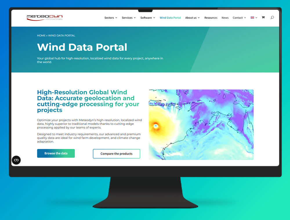
In December 2025, CLS Group announced the launch of the Wind Data Portal, a new online platform developed by its subsidiary Meteodyn, from its headquarters in Saint-Herblain, France.
This innovative platform gives wind energy professionals instant access to high-resolution global wind data, supporting both onshore wind projects and offshore wind development.
Designed to accelerate the deployment of renewable infrastructures worldwide, the Wind Data Portal helps developers, consultants and investors reduce uncertainty, assess sites faster, and improve technical and financial decision-making.
What is the Wind Data Portal and why does it matter?
The Wind Data Portal is a digital platform that provides precisely geolocated wind datasets for any location on Earth. Instead of depending on measurement campaigns that require months to set up and process, developers can now access ready-to-use wind resource data in just a few clicks, as a first step.
The platform includes:
- Onshore Met Mast powered by CFD technology
- Offshore Met Mast powered by SARWind technology
- Climate Change Analytics
- Meso-Microscale Coupling
This makes it possible to screen sites rapidly, compare development zones, and prepare robust wind resource assessments early in the planning phase.
As Frank Lancelot, CEO & General Manager of Meteodyn, explains: “In just a few clicks, you have access to high-resolution, precisely located wind data anywhere in the world, for both onshore and offshore wind projects.”
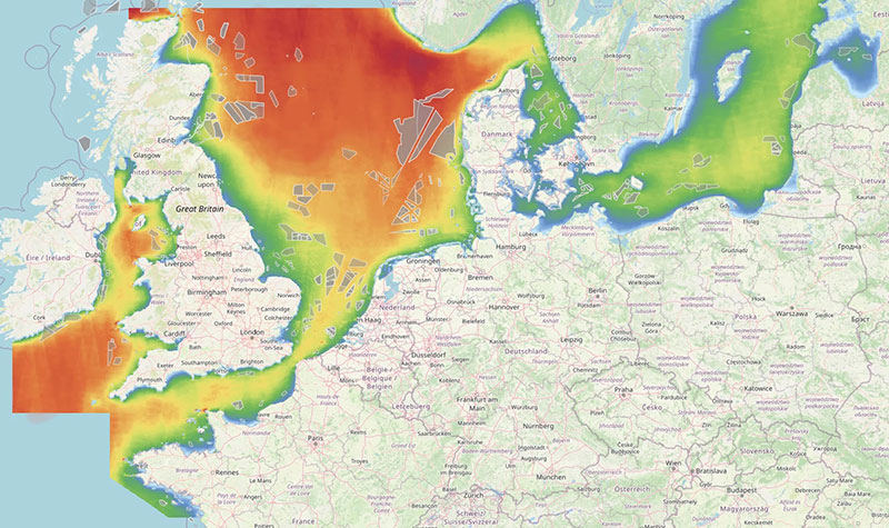
High-Resolution Wind Data for Onshore Projects
CFD Modeling for any type of Terrain
For onshore development, the Wind Data Portal offers microscale CFD simulations at 50-meter horizontal resolution, capturing the fine-scale effects of terrain, obstacles, valleys, and atmospheric stability.
This level of detail is essential for optimizing turbine placement and reducing uncertainty in annual energy production (AEP).
Wind farm developers benefit from accurate, local-scale resource evaluation, enabling better engineering decisions from the start.
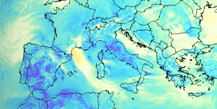
Satellite-Based Offshore Wind Data with SARWind
500-Meter Resolution for Remote Marine Environments
Offshore wind development requires datasets capable of characterizing wind conditions in areas where measurements are limited.
The Wind Data Portal integrates SARWind a unique satellite-derived product that uses more than 330,000 SAR images processed by CLS.
This provides offshore wind fields with 500-meter horizontal resolution, offering unmatched spatial detail for:
- identifying promising development zones,
- comparing wind conditions across offshore areas,
- evaluating long-term performance,
- and supporting environmental and engineering studies.
SARWind strengthens early feasibility assessments by delivering consistent, high-quality offshore wind data anywhere in the world.
Climate Change Analytics for long-term wind resource planning
Wind farms operate for 20 to 30 years, making long-term resource evolution a key factor in investment decisions. The Wind Data Portal integrates Climate Change Analytics based on authoritative climate models and IPCC-aligned scenarios.
This feature helps developers and investors:
- anticipate how wind patterns may change,
- quantify climate-related risks,
- secure financing with stronger technical justification,
- ensure long-term resilience of wind assets.
Climate scenarios are essential for ensuring that future wind farms remain productive, reliable, and aligned with the evolving energy landscape.
A Platform designed to accelerate wind development
Faster screening, better decisions
Beyond its scientific and satellite-powered datasets, the Wind Data Portal is designed to accelerate project timelines.
By centralizing advanced atmospheric modeling and simplifying access to high-resolution data, it allows users to:
- evaluate multiple sites rapidly,
- estimate energy production early in development,
- support turbine layout optimization,
- reduce engineering uncertainty,
- and prepare financial documentation with stronger evidence.
As Frank Lancelot highlights: “Developers need reliable data very early in their projects. Waiting months for on-site measurements is no longer an option.”
The Wind Data Portal answers this challenge with speed, precision, and global coverage.
Supporting CLS Group’s mission for the global energy transition
The Wind Data Portal strengthens CLS Group’s leadership in Earth observation and environmental intelligence applied to renewable energy.
By making high-resolution wind data available worldwide, Meteodyn and CLS contribute directly to the development of sustainable, resilient, and climate-aligned energy infrastructures.
In a world that must rapidly expand wind capacity, both offshore and onshore, access to reliable, scientifically robust wind data is indispensable.
Through the Wind Data Portal, CLS enables faster, better-informed renewable energy deployment.
FAQ: Wind Data Portal by Meteodyn
What is the Wind Data Portal?
The Wind Data Portal is an online platform developed by Meteodyn (a CLS company) that provides high-resolution, global wind data for onshore and offshore wind projects. It enables users to download ready-to-use wind datasets in just a few clicks.
Who is the Wind Data Portal designed for?
The platform is designed for wind developers, engineering firms, consultants, investors, and researchers who need accurate wind resource data to evaluate, design, or optimize wind energy projects.
What types of wind data are available?
The portal offers Virtual Met Masts, SARWind® satellite-based offshore wind data, high-resolution CFD modeling for onshore sites, climate change analytics based on global climate models, and Meso-Microscale Coupling data.
How does SARWind® improve offshore wind assessment?
SARWind® uses satellite SAR imagery processed by CLS to deliver offshore wind maps with resolutions down to 500 meters. This method is particularly useful in remote offshore areas where no in-situ measurements exist.
Can the Wind Data Portal support early-stage wind development?
Yes. By providing immediate access to global wind data, the platform helps developers screen potential sites, estimate energy production, and reduce uncertainties early in the project lifecycle.
Does the portal include climate change analysis?
Yes. Meteodyn integrates climate scenarios to help users assess how wind resources may evolve in the coming decades, improving long-term planning and project bankability.
How does the Wind Data Portal support the energy transition?
By making high-quality wind data accessible worldwide, the portal accelerates renewable energy deployment, supports engineering decisions, and strengthens the resilience of future energy infrastructures.