
Turbulence Intensity Correction for Floating LiDAR Systems in Offshore Wind
- June 12, 2026
- Category: News
As the number of offshore wind projects continue grow, floating LiDAR systems are becoming increasingly important for accurate wind resource assessment. Among the many parameters measured during related offshore campaigns, Turbulence Intensity (TI) plays a critical role in evaluating turbine performance, structural fatigue loads, and the long-term reliability of the offshore wind infrastructure.
What Is Turbulence Intensity?
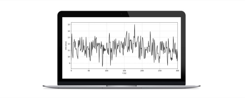
TI is a non-dimensional statistical quantity that describes the variability of wind speed fluctuations over a given measurement period, typically 10 minutes. It is defined as the ratio between the standard deviation of wind speed fluctuations and the average wind speed over the same period.
Accurate TI assessment is essential because it directly influences:
- turbine selection,
- engineering design,
- fatigue load estimation,
- maintenance strategies,
- and wind turbine service life prediction.
Poor estimation of TI conditions may lead to increased mechanical wear of turbine components and higher operational costs over time.
Challenges of Measuring Turbulence Intensity with Floating LiDAR
Unlike conventional instruments such as cup or sonic anemometers, LiDAR systems estimate TI indirectly by scanning atmospheric scatterers moving within the air at different elevations (layers). As a result, the LiDAR-derived TI time series differ fundamentally from the direct point measurements obtained with traditional sensors.
In offshore environments, measuring TI becomes more complicated due to the continuous motion of the floating platform caused by changing marine conditions (wind, wave, currents). This buoy motion can significantly affect the quality of the measurements and introduce artifacts into the estimates if no adequate correction methodology is applied.
Another challenge for the offshore wind industry is the absence of universally accepted standards for TI correction in floating LiDAR applications. Existing methodologies generally rely on theoretical or empirical models and require collocated high-frequency motion measurements. However, depending on the LiDAR sampling configuration and environmental conditions, these approaches may present limitations.
CLS DeepCLidar Motion Correction Methodology
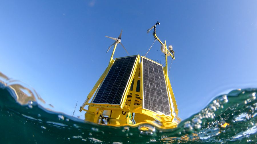
To address these challenges, CLS has developed a motion correction methodology specifically applicable to the DeepCLidar buoy characteristics and sampling configuration. Unlike conventional approaches, this methodology performs a transformation of TI estimates into a fixed frame of reference and is independent of the sampling interval.
An additional advantage of this approach is its ability to remove eccentricity effects caused by the position of the probe relative to the buoy’s center of mass. This contributes to improving the consistency and reliability of offshore wind measurements.
The methodology developed by CLS results in:
- improved offshore TI measurement accuracy,
- reduced uncertainty in wind resource assessment,
- and more reliable measurements.
Offshore Wind Measurement Results and Error Reduction
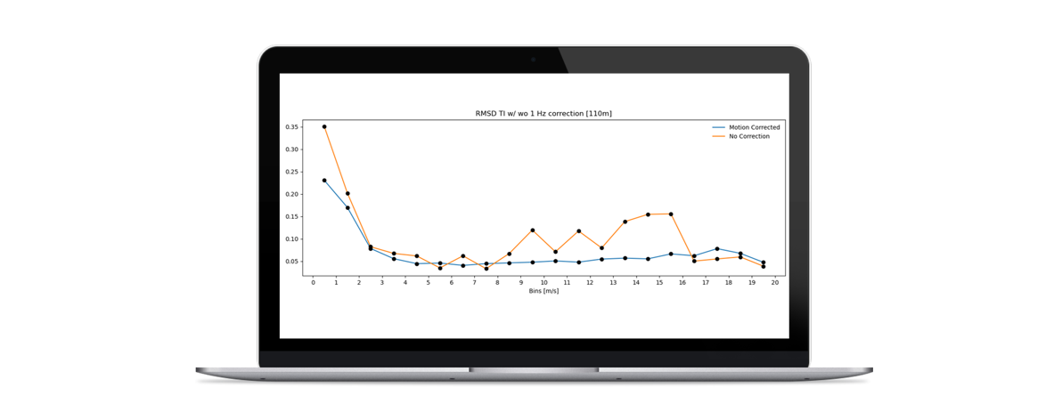
The figure below presents the results obtained during a previous offshore DeepCLidar measurement campaign at an elevation of 110 meters. The comparison between corrected and non-corrected TI estimates highlights a significant reduction in Root Mean Square Error (RMSE), particularly for wind speeds ranging from 9 m/s to 16 m/s.
In this wind speed range (of significant importance to offshore operations), the error decreases by up to 60%, demonstrating the effectiveness of the correction methodology under realistic offshore conditions. These results highlight how impactful accurate estimates of TI can be for offshore wind resource characterization and turbine operational analysis.
Continuous Offshore Wind Innovation at CLS
CLS continues to refine and validate this correction technique with each deployment and through ongoing expe
riments performed a
t its offshore test facility located in False Bay, South Africa. This development supports the growing need for reliab
le and accurate floating LiDAR measurements as the offshore wind industry grows worldwide.
By improving TI correction methodologies, CLS contributes to:
- reducing uncertainty in offshore wind resource assessment,
- improving floating LiDAR data quality,
- and enhancing the reliability of offshore wind projects.
As floating offshore wind continues to expand globally, robust and validated motion correction techniques will remain essential to ensure high-quality offshore wind measurements.ç
About DeepCLidar
DeepCLidar is CLS’s floating LiDAR solution dedicated to offshore wind measurement campaigns and environmental monitoring. The system enables accurate offshore wind profiling across multiple elevations while integrating advanced motion correction capabilities.
DeepCLidar supports offshore wind developers and engineering teams in obtaining reliable wind measurements for project development, turbine assessment, and operational optimization.