
Introducing DeepCLiDAR
The most advanced floating LiDAR buoy and offshore wind resource assessment suite on the market.
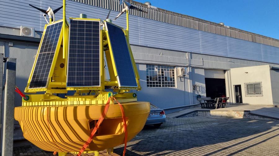
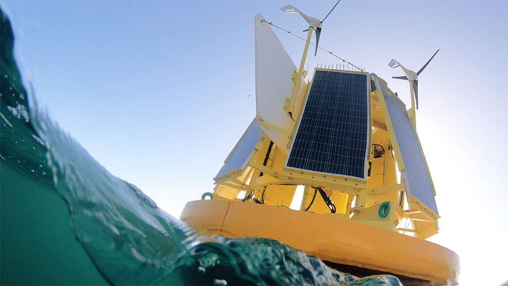
DeepCLiDAR is CLS Group’s next-generation Carbon Trust certified floating LiDAR buoy. It delivers investment-grade wind profile data up to 300 m above sea level with high accuracy and reliability.
DeepCLiDAR’s autonomous operation makes it ideally suited for deployment in coastal, shelf, and deep-water environments, including some of the most challenging offshore conditions on the planet.
Its Carbon Trust certification, field-tested resilience, and global support network de-risk every project phase—from site selection to plant optimization.
When paired with CLS’s SARWind service – an archive of over 18 years of satellite Synthetic Aperture Radar (SAR) wind data enhanced by AI and high-resolution WRF modeling- DeepCLiDAR forms the backbone of a fully integrated offshore wind resource assessment suite.
Why Choose DeepCLiDAR?
100% U.S. Engineered & Validated
Qualifies for domestic content incentives
Industry-Leading Data Integration
The only system combining floating LiDAR, 18-year SAR climatology, and in-house WRF modeling
Global Reach, Local Support
Production in Cape Town, Southern Africa, with service teams on 5 continents for fast mobilisation an responsive support
Performance You Can Trust
DeepCLiDAR has been engineered to meet the demanding standards of today’s offshore wind market. It offers exceptional accuracy, with a mean bias error of less than 2%, and its range extends up to 300 meters—exceeding the hub and tip heights of next-generation 15+ MW turbines.
The buoy can operate independently for over two weeks without charging and requires service visits as infrequently as once a year. Its rugged build has already been proven in the field, withstanding the full force of Hurricane Franklin (Category 4) in 2023 without any data loss.
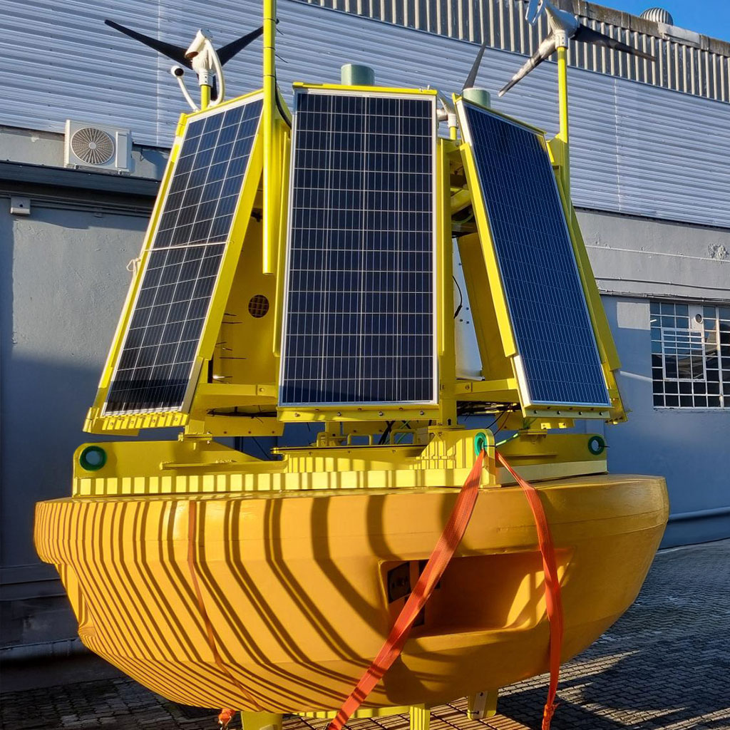
ZX 300M LiDAR Sensor
Wind profiles up to 300 m
Wave Measurement
Seaview 603 HR Sensor
Current Measurement
Broad range of current sensors
Modular Construction
for easy transportation
10+ Years of Operational Reliability
based on buoy system technology
Sensor Compatibility
with a wide range of environmental instruments
Global Manufacturing & Support
CLS’s Cape Town facility, CLS Soutern Africa, powers industrial-scale production, integrating renewable energy and local supply chains for competitive pricing and sustainability.
With engineering hubs in the U.S., Europe, South Africa, Australia, Brazil, and Indonesia, CLS offers global expertise and local agility.
End-To-End Offshore Wind Resource Assessment
with SARWind Integration
DeepCLiDAR is more than a buoy—it is the cornerstone of an end-to-end wind resource assessment platform that merges space borne, in situ, and high-resolution wind flow modelling techniques. By delivering precise, continuous, and bankable data in any marine environment, CLS helps offshore wind stakeholders de risk projects, secure financing, and maximize energy yield.
DeepCLiDAR
Deployed to reference sites
to collect vertical wind, wave, current, and meteorological data.
SARWind
18-year SAR archive with AI-corrected wind fields at 250 m resolution—anywhere on Earth.
High-Resolution WRF Modeling
Meteodyn’s advanced modeling merges LiDAR and SAR data for full-array wind field simulation.
Ready to Maximize the Value of
Your Offshore Wind Projects
Discover how DeepCLiDAR can deliver the accuracy, resilience, and data depth
you need to develop your project with confidence.
Latest News
Consistent Results from DeepCLiDAR at South African site
Near a South African MPA, DeepCLiDAR gathered high-quality data for 7+ months in harsh wind conditions.
Unlocking Turbulence Intensity Accuracy in Offshore Wind with DeepCLiDAR
Improve turbulence intensity measurements in offshore wind with DeepCLiDAR. Unlock new accuracy for reliable resource assessments.
Wind Tech Innovations: Floating LiDAR as a Pillar of Sustainable Development
By Sidney Bilski, metocean expert with 25 years of experience, Head of Sales, Marketing & QHSE at CLS Southern Africa.
Your success starts with the right solution
Let’s discuss your needs and explore how our expertise can drive your project forward.
Contact us now to start the conversation.