Consistent Results from DeepCLiDAR at South African site
- May 13, 2025
- Category: News
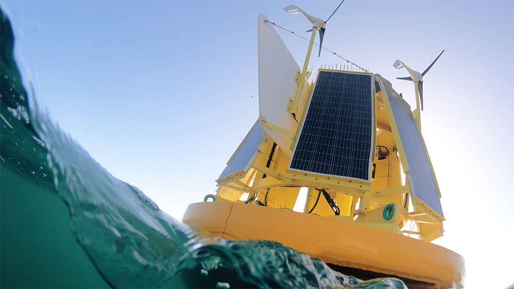
In a carefully chosen location near a Marine Protected Area (MPA) off the southern coast of South Africa, CLS’s DeepCLiDAR floating LiDAR system has been continuously collecting atmospheric and metocean data for over 7 months and delivering remarkably high-quality outputs through intense and rapidly shifting wind regimes.
Robust Wind Profiling, Confirmed by Data
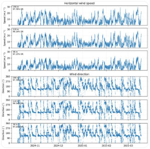 The campaign dataset reveals consistently strong wind conditions across all measured altitudes, with time series data from 38 m, 118 m, and 198 m shown below. Horizontal wind speeds frequently exceeding 20–25 m/s, and even approaching 30 m/s during peak events.
Overall System Availability (OSACA) exceeded 99,9% and Overall Post-processed Data Availability (OPDACA) reached over 96.6%, confirming DeepCLiDAR’s resilience in real-world offshore conditions.
Such high data return rates are crucial for investment-grade resource assessment, especially when validating wind regimes in high-variability zones where turbine performance modeling and fatigue load estimation are particularly sensitive to data continuity and resolution.
Validation of Turbulence Intensity Capability
This campaign is also serving as a testbed for CLS’s new turbulence intensity (TI) methodology, developed in partnership with our U.S. subsidiary Woods Hole Group.
TI is crucial for turbine design and structural fatigue assessment, annual energy production (AEP) modeling, and wake effect management.
Whether you’re prospecting a new lease area or supporting your environmental permitting file, DeepCLiDAR brings together performance, scalability, and responsibility in one platform.
Ready to explore the full dataset or discuss integration for your next campaign?